![]()
Computer simulations of the climate on the territory of the Balkan Peninsula and the Black Sea region have been developed by scientists under the National Science Programme “Environmental Protection and Reduction of the Risk of Adverse Events and Natural Disasters”. As a result, regional climate databases have been generated for the periods 1975-2005 (current climate), 2020-2050 (near future) and 2070-2100 (far future). Simulations of future climates were made for the three commonly accepted global climate change scenarios: optimistic, stabilizing and pessimistic. A number of climate indices are calculated that assess the impact of a given past/present and/or future climate on the environment, human health, ecosystems and various aspects of economic activity.
Within the framework of the project, model estimates of the water runoff of the rivers Mesta and Struma and of the water balance of their catchments on Bulgarian territory were prepared. The formation of groundwater resources was assessed, and the hydrogeological conditions for groundwater formation in different types of aquifers were clarified. The obtained results enable the solving of a number of applied problems for the assessment and management of water resources.
A methodology for the assessment of the ecological status of the river Danube through fish fauna, as well as indicators and metrics to assess the status of standing waters based on cenotic parameters of zooplankton is developed. The forms, modes and sources of groundwater pollution caused by municipal waste dumps, current and former mining facilities for mineral extraction are investigated.
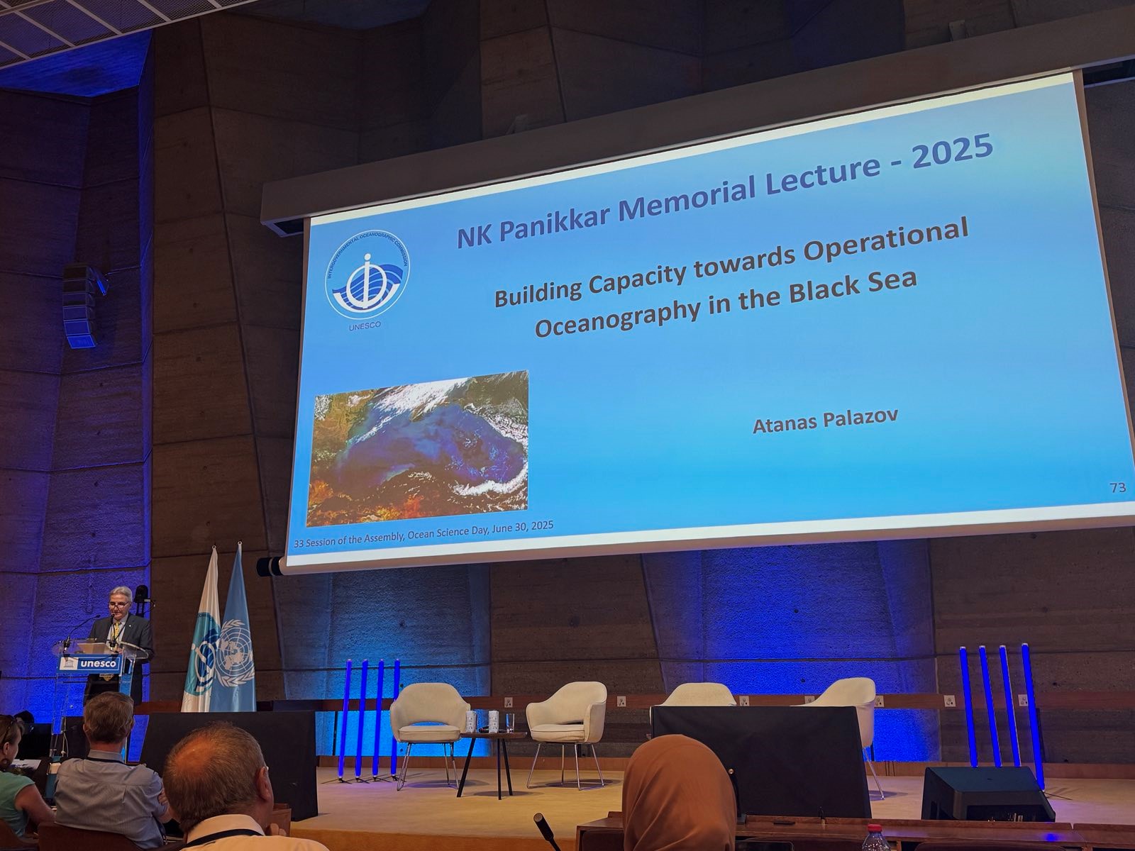
The climatic map of the velocities of surface currents near the Bulgarian coast has been updated, and seasonal maps of currents have been obtained. The diurnal dynamics of biogenic elements and oxygen concentrations in seawater have been determined. The results are extremely important for the study of metabolic processes of autotrophic and heterotrophic marine organisms in natural conditions.
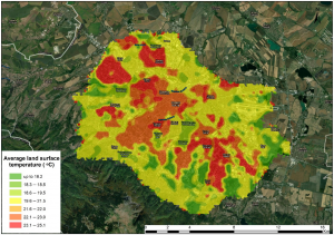
Map of the spatial distribution of mean surface temperatures in Sofia (source: https://www.mdpi.com/2073-4433/12/11/1370
Scientists have conducted multi-scale, multi-year computer simulations and calculated indices of air quality in Sofia. For each index, the dominant pollutant leading to its formation was calculated. A new advanced empirical model of biologically active UV radiation was created.
Geochemical data were obtained in Bulgarian sections for trace element contents, increased mercury and organic matter contents which mark a global event that triggered abrupt warming of the Earth’s climate about 183 million years ago. The Campanian-Mastrichtian Boundary Event (73-71 M years) marking the first significant global cooling of the Earth at the end of the Cretaceous period was demonstrated by two independent methods, biostratigraphic and geochemical.
In 2021, 1 genus and 9 species were identified as new to the mycota of Bulgaria. Three of them are new species for the whole Balkan Peninsula. Selected, identified and stored in the gene bank of the Institute of Agriculture – Kyustendil are old pear, apple, cherry varieties. Data on the status of populations of rare plant communities and species of plants and animals vulnerable to climate change were obtained.
An integrated methodology for creating digital terrains models with flood hazard and risk purposes has been prepared based on the use of unmanned aerial systems and ground measurements. Approaches, methods and models are being developed for the effective use, protection and stimulation of the regulating ecosystem services for hazard reduction and mitigation of adverse weather and hydrospheric events.
On the basis of sedimentological and engineering geological studies, the structure of the Neogene rock complexes forming the Dobrudzha Plateau in the area between the town of Kavarna and Cape Shabla has been established. The characteristic physical and mechanical indicators predetermining the occurrence of dangerous geological processes on the periphery of the plateau have been identified.
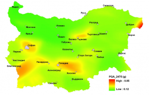
Seismic hazard for recurrence period 2475 yr, “scale”
The seismic hazard for the territory of the country with large recurrence periods has been assessed. The recurrence periods of strong earthquakes (with magnitude above 6.0) have been assessed. Engineering and geological conditions in a number of cities have been mapped in detail, and deterministic and probabilistic seismic scenarios have been developed to estimate damage and destruction of buildings, casualties and economic losses due to a catastrophic earthquake.
Specific protection targets have been developed for 13 sites of the national Natura 2000 network. Key objectives have been formulated for maintaining or restoring the favourable nature protection status of the target sites in these areas.
The national scientific programme “Environmental Protection and Reduction of the Risk of Adverse Events and Natural Disasters ” is funded by the Ministry of Education and Science and implemented by scientists from nine scientific organisations and universities.